This update has been sent to SYC Boaters, the Sailors List and the Boaters Coalition.
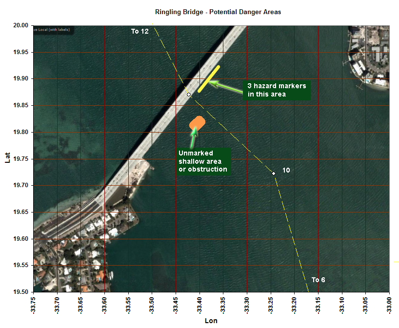
Dave Munro and I went out again on Friday in Dave’s boat. (If you are not familiar with HepCat, it a very hi-tech boat with sophisticated GPS and sonar recording equipment). We took a number of additional sweeps of the area of interest that we told you about last week and reaffirmed our findings. At location 27o 19.817’ N 82o 33.399’ W a peak was found with 7.65 feet at MLLW. The significance is that on a negative tide, deep draft boats could encounter serious trouble as several already have. In fact, these accidents may have inadvertently lowered this peak to its current depth. I have notified FDOT and WCIND of this finding so that they investigate this new area and see that it is marked. In the meantime, stay clear. The attached picture provides the location of the area of concern and also shows the chart location of marks that currently exist including Fl R 4s 16ft 3M “10” which appears to be a safe course from the center of the bridge. However, neither Dave nor I take any responsibility for the accuracy of information in this email or in the attached chart.